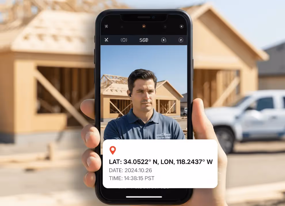
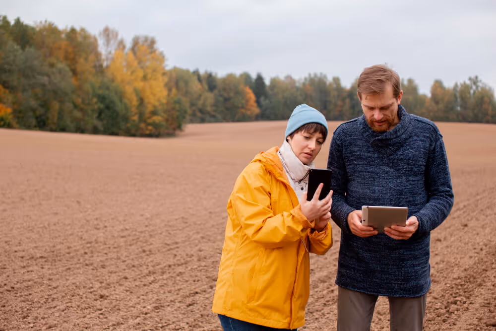
When a delivery driver needs to prove they reached the correct address at the exact time, or when a construction supervisor must document site conditions with verifiable evidence, standard smartphone photos fall short. Without embedded GPS coordinates and timestamps, photos become just images—lacking the crucial context that transforms them into reliable documentation.
This growing need for geotagged, timestamped photo evidence has created a challenge for businesses across industries. While specialized GPS camera apps exist, they often come with limitations: expensive subscriptions, clunky interfaces, or features that don't quite fit specific business workflows. The solution lies in building custom mobile applications that capture photos with automatically embedded location data and time information—all without writing a single line of code.
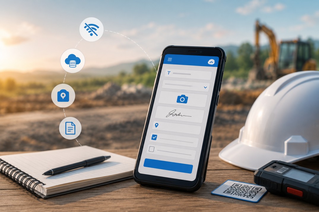
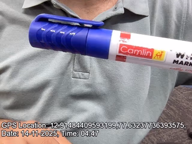
GPS photo capture involves automatically embedding geographic coordinates, date, and time information directly onto images at the moment they're taken. Unlike metadata that can be stripped or altered, visible watermarks on photos provide immediate verification of when and where documentation occurred.
Standard smartphone cameras store location data in EXIF metadata, which gets removed when photos are shared through messaging apps or social media. This creates several problems:
Businesses in construction, field services, logistics, and real estate management need photos that serve as verifiable proof—not just visual records.
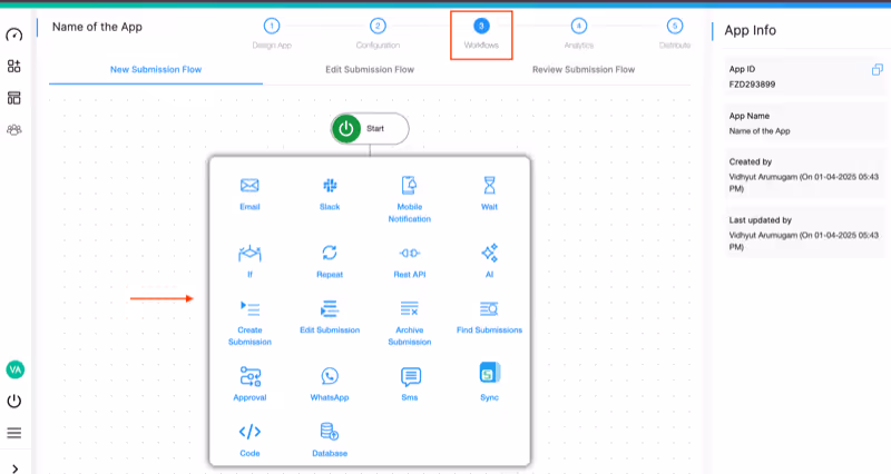
Building an effective GPS timestamp camera solution requires specific capabilities that transform simple photo capture into comprehensive documentation:
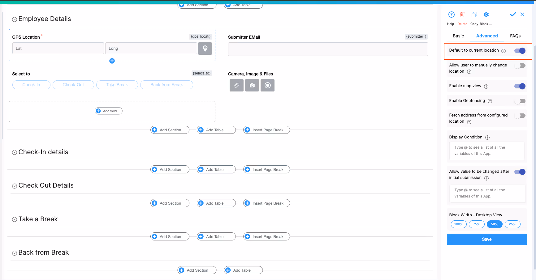
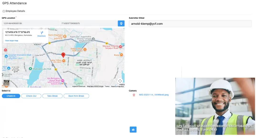
The GPS Location block automatically detects and records the user's current position when taking photos. This includes:
Automatically embedding the current date and time ensures accurate chronological records. The Date Selector and Time Selector blocks can automatically capture current timestamps, preventing manual entry errors and ensuring consistency across all documentation.
The Camera, Images & Files block enables direct photo capture from mobile devices while automatically associating images with GPS coordinates and timestamp data. Unlike standalone camera apps, this integrated approach ensures all documentation elements stay connected.
Field teams need mobile apps that work offline, sync automatically, and remain accessible even in areas with poor connectivity. This mobile-first design ensures uninterrupted documentation regardless of network availability.
Creating a custom GPS timestamp camera application requires no coding expertise. Here's how to build your solution:
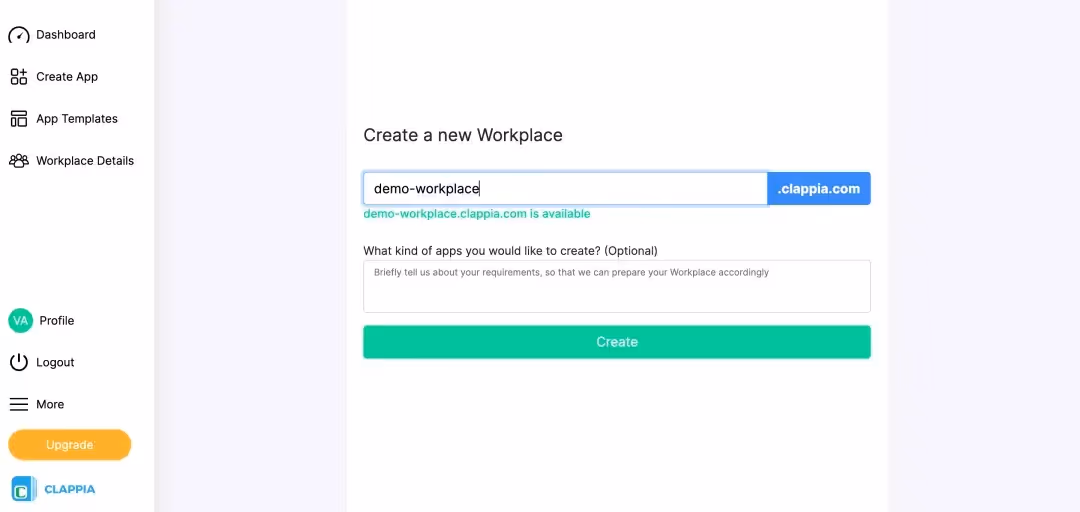
Sign up for free on Clappia and create a workplace for your organization. This centralized workspace will house all your custom applications and enable team collaboration.
Click the plus button to create a new app. Name it descriptively, such as "Field Photo Documentation" or "Site Inspection Camera."

Add the GPS location block and In the right panel configuration, enable "Default to current location" toggle. This automatically captures coordinates when users open the form.
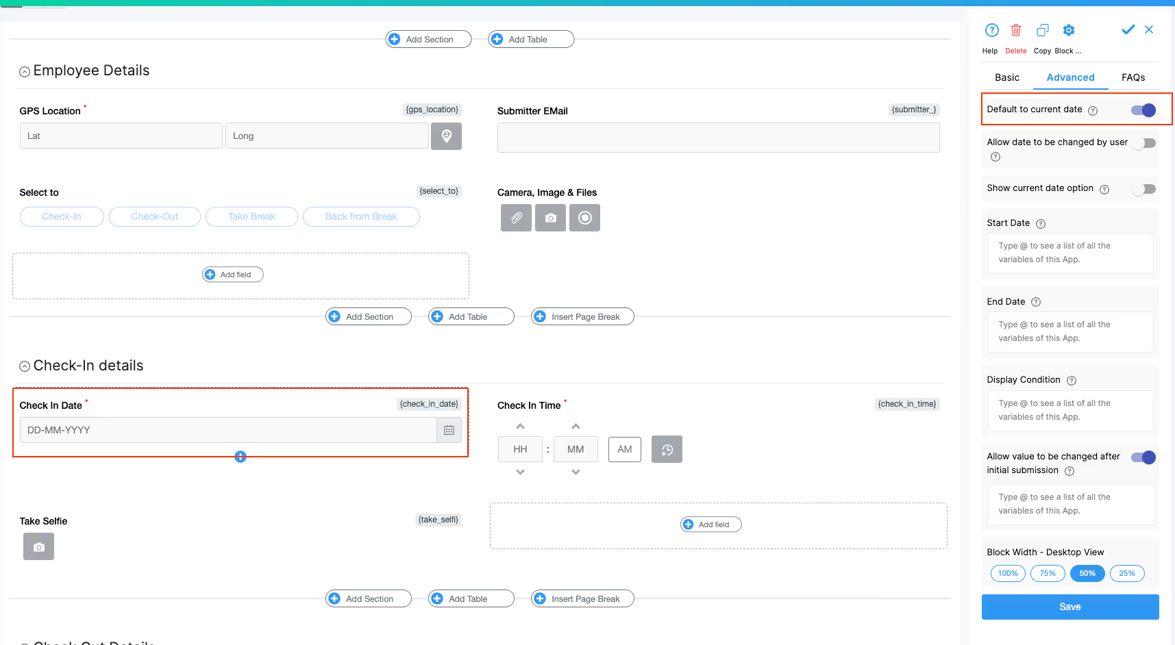
Add the Date Selector block. In configurations, enable "Default to current date" to automatically capture today's date.
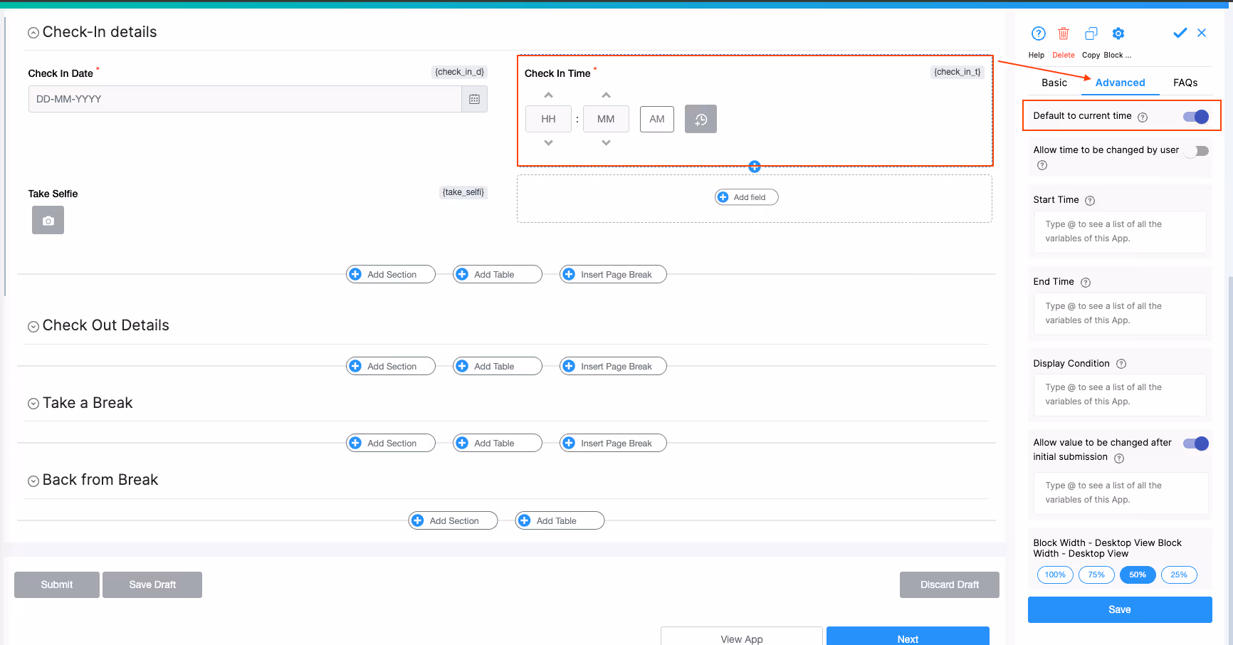
Add the Time Selector block. Enable "Default to current time" to automatically capture the current time.
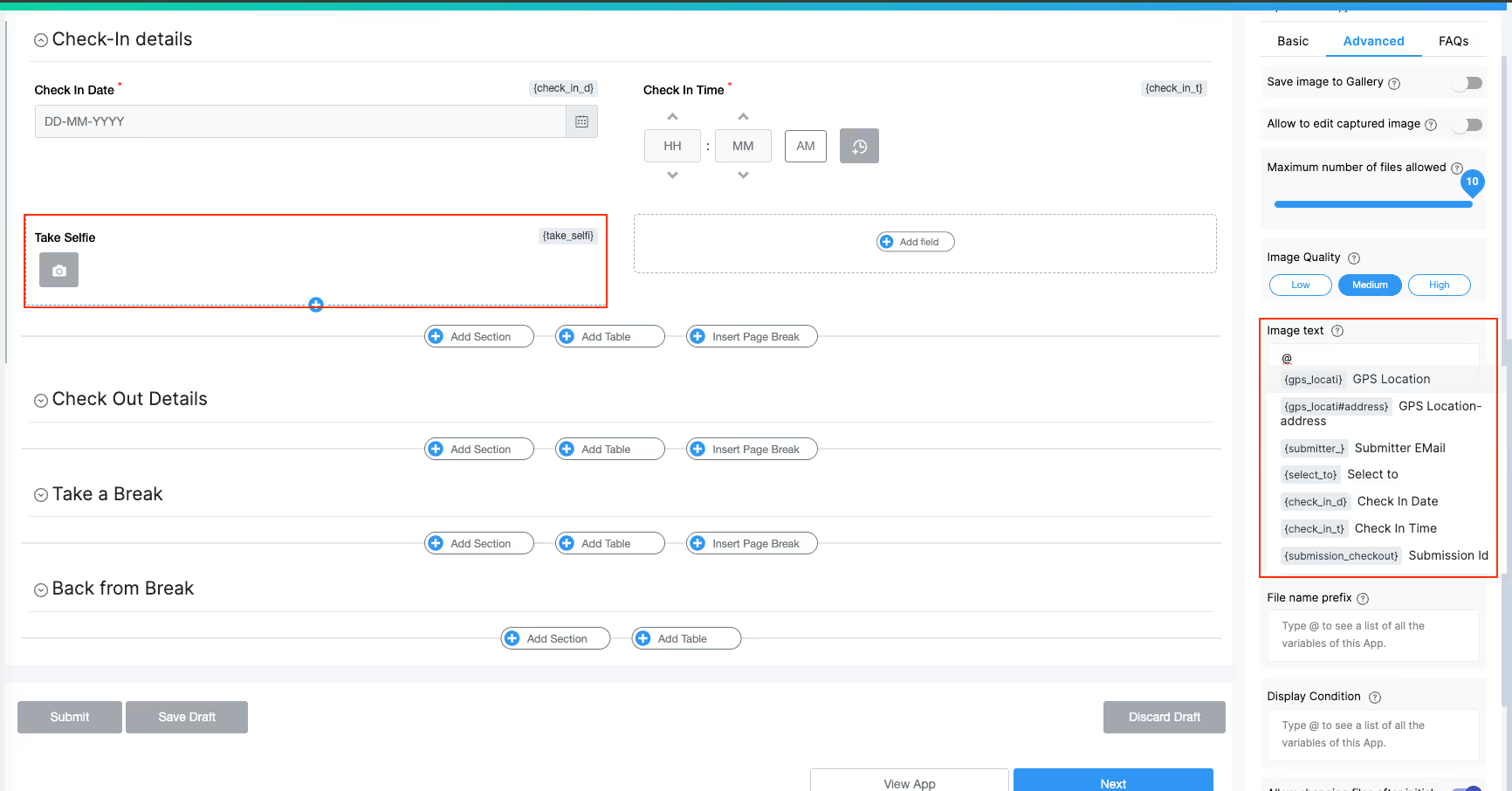
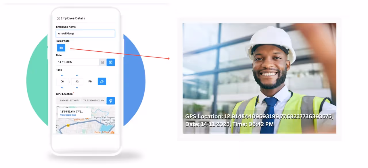
Add the Camera, Images & Files block. Here's the critical configuration:
@ to see the list of variables'GPS Location: ' & {gps_location} & ', ' &
'Date: ' & TEXT({check_in_date}, "DD‑MM‑YYYY") & ", "&
'Time: ' & TEXT({check_in_time},"hh:mm")
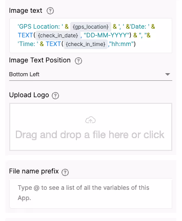
If you want to include the user's name, add: Employee: {submitter_name}
Click Save. Now every photo captured will automatically display GPS coordinates, date, and time stamps directly on the image.
For additional fields like project names, categories, or notes, you can add Single Line Text or Dropdown blocks based on your specific requirements.
That's it! With just these three blocks (GPS Location, Date Selector, Time Selector) and the Camera configuration, you have a fully functional GPS timestamp camera. The remaining steps cover optional advanced features for specific business needs.
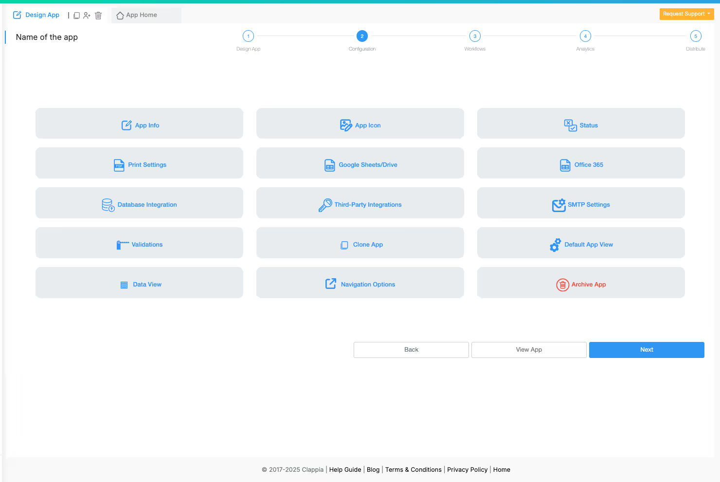
If needed, navigate to the configurations tab to add:
For most use cases, the basic GPS timestamp setup from Step 3 is sufficient. Additional configurations depend on your specific workflow needs.
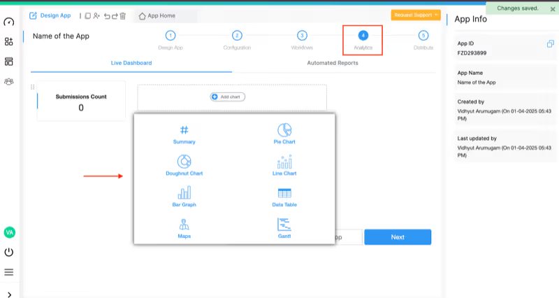
Set up analytics dashboards to track documentation patterns:
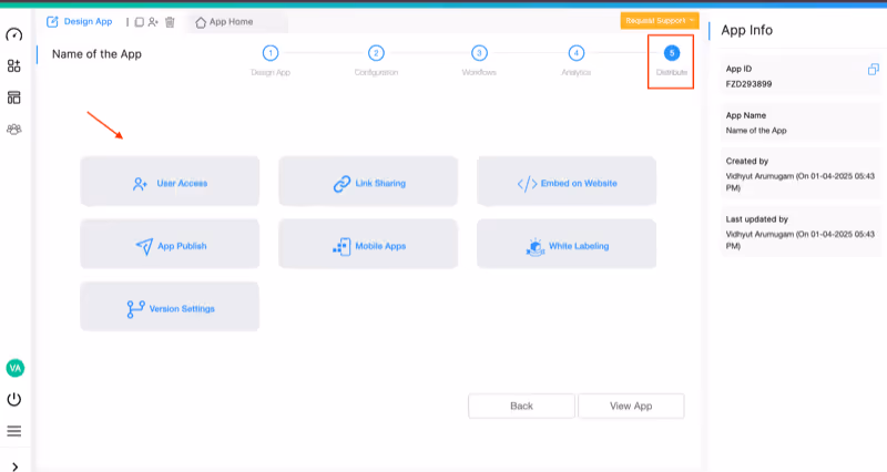
Make the app accessible to field teams through multiple channels:
Before rolling out to your team, test the app:
Once verified, your GPS timestamp camera is ready for field use. For detailed guidance on additional features, visit the help documentation.
Using on Mobile Devices:
GPS timestamp camera applications serve diverse business needs:
Construction teams use GPS-timestamped photos for daily progress documentation, safety compliance verification, and site inspection reports. Photos with embedded location and time data resolve disputes about work completion and site conditions.
Service technicians capture before-and-after photos of repair work, equipment installations, and maintenance activities. GPS coordinates prove technicians visited correct locations while timestamps verify service completion times.
Delivery drivers document package drop-offs with photo proof showing exact delivery locations and times. This reduces disputed deliveries and provides customers with verifiable delivery confirmation through the customer order tracking system.
Property managers document maintenance issues, conduct inspections, and maintain property condition records with geotagged photos. Real estate agents capture listing photos with location verification for accurate property documentation.
Safety officers photograph hazards, compliance violations, and corrective actions with timestamps that prove when issues were identified and resolved. This creates audit trails for incident reporting systems and regulatory compliance.
Healthcare workers document patient conditions, equipment status, and facility conditions with geotagged photos. Emergency responders capture scene documentation with precise location and time information for investigations and insurance claims.
Beyond basic GPS timestamp capture, advanced capabilities elevate documentation quality:
The Live Tracking feature enables real-time location monitoring of field teams. Supervisors can see where photos are being captured in real-time and track team movements throughout the workday.
Geofencing functionality ensures photos are only captured within designated areas. This prevents documentation from incorrect locations and enforces compliance with site-specific protocols.
Add company logos, project names, and custom text overlays to photos for professional presentation. This white-labeling capability ensures documentation reflects your brand identity.
Implement validation rules that require specific fields before submission. This ensures comprehensive documentation with all necessary context beyond just photos and locations.
Connect multiple apps to create comprehensive workflows. Pull data from inventory systems, customer databases, or project management tools to enrich photo documentation with additional context.
Include digital signatures alongside GPS-timestamped photos for formal approvals, customer sign-offs, or compliance verification.
Purpose-built GPS timestamp camera applications provide advantages over generic photo apps:
Photos with visible GPS coordinates and timestamps create indisputable evidence of when and where documentation occurred. This protects businesses in disputes and audits while building customer trust.
Automated data capture eliminates manual recording tasks. Field teams focus on their core work while the system automatically handles location tracking, time stamping, and data organization.
All photos and associated data flow into centralized databases accessible to authorized team members. This eliminates the chaos of photos scattered across individual devices and email chains.
With the free plan allowing unlimited apps and up to 100 users, businesses can test and validate solutions before investing. Paid plans start affordably and scale cost-effectively with user growth.
Unlike rigid GPS camera apps, custom-built solutions adapt to unique business processes. Add fields, change workflows, and modify interfaces without technical dependencies or expensive development.
Field teams work uninterrupted even without internet connectivity. The mobile app captures all data offline and automatically syncs when connection returns, ensuring no documentation gaps.
Building a GPS timestamp camera application requires no technical expertise. The no-code platform provides intuitive tools that transform documentation processes:
Start with the free plan that includes unlimited apps, up to 100 users, and 400 monthly submissions—perfect for testing and small-scale deployment. As documentation needs grow, affordable paid plans starting at $6 per user per month provide unlimited submissions and advanced features.
The platform's mobile-first architecture ensures field teams get native Android and iOS apps that work seamlessly offline, sync automatically, and provide the professional experience your business demands. Whether you need simple photo documentation or comprehensive field service management, the flexibility to customize every aspect ensures the solution fits your exact requirements.
Ready to transform your photo documentation with GPS timestamps and date capture? Start building your custom GPS timestamp camera app today and experience how no-code development eliminates the gaps between your documentation needs and available tools.
 Get Started – It’s Free
L374, 1st Floor, 5th Main Rd, Sector 6, HSR Layout, Bengaluru, Karnataka 560102, India
3500 S DuPont Hwy, Dover,
Kent 19901, Delaware, USA


3500 S DuPont Hwy, Dover,
Kent 19901, Delaware, USA
L374, 1st Floor, 5th Main Rd, Sector 6, HSR Layout, Bengaluru, Karnataka 560102, India
.svg)

.jpg)

.webp)
.avif)